To continue exploring our datasets, return to statistics.gov.scot
Welcome to the new look statistics.gov.scot. We’ve been working on some changes to the way that our open data portal works, and will be releasing them soon.
Apart from a new colour scheme and home page layout, we’ve developed a new way for you to work with areas – the statistics.gov.scot Atlas.
As before, our data portal contains datasets which are structured by statistical and administrative geographies. The Atlas allows you to browse these using an interactive mapping window. You can see how smaller geographies relate to the larger areas they are nested within. And you can use the map to add geographical units to your data cart, when making bespoke collections of geographies and extracts from datasets.
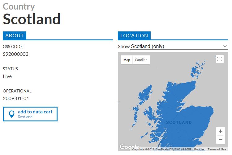
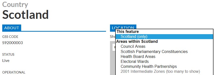
When you navigate to the Atlas from the homepage (for instance by clicking on the “ATLAS” tab on the top right of the page), the default setting is for Scotland:
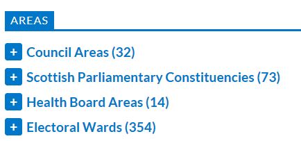
Further down the page, you’ll find new look versions of familiar features, such as the lists of areas nested within the geography you’re looking at (if you expand one of them, there is a button at the end of the list to add all those areas to the data cart):
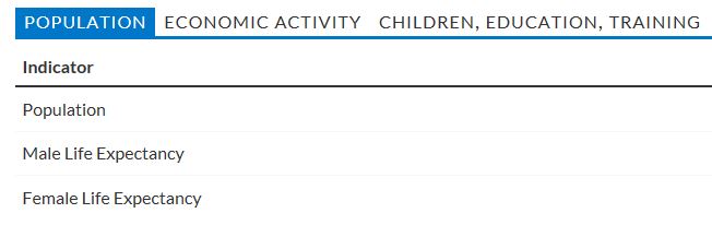
Area profiles are now grouped according to topic:
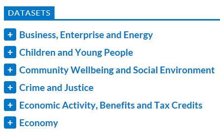
And there is a list of datasets available for the geography you’re examining, grouped by theme:
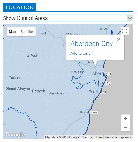
Using the drop down menu above the map allows you to change the map view to show a different geographic level. For example, to see the council areas within Scotland, select them from the list of areas within Scotland:
You can select individual geographical units directly in the map window, by either clicking on the name (to navigate to its page) or by clicking on “Add to cart” to add this unit to the data cart:
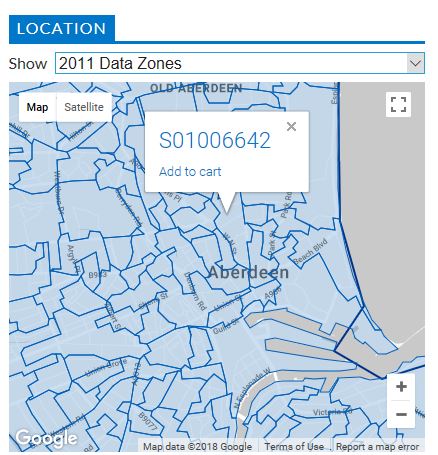
You can continue to use the drop down menu to show smaller geographies nested within the larger area that you selected. This is particularly useful for selecting a collection of small area geographies such as data zones. Previously, it was necessary to look them up individually, but you can now select them from the map when making a collection of data and geographies in the data cart:
SUMMARY
- Use the drop down menu above the map to select the type of geographical unit you need
- Click on individual areas in the map to find out more about them, or add them to the data cart
- Use the lists below the map to see full lists of geographies, and lists of datasets available
- Browse the area profiles to find quick summary facts about the places you’re interested in
To continue exploring our datasets, return to statistics.gov.scot